Flooding
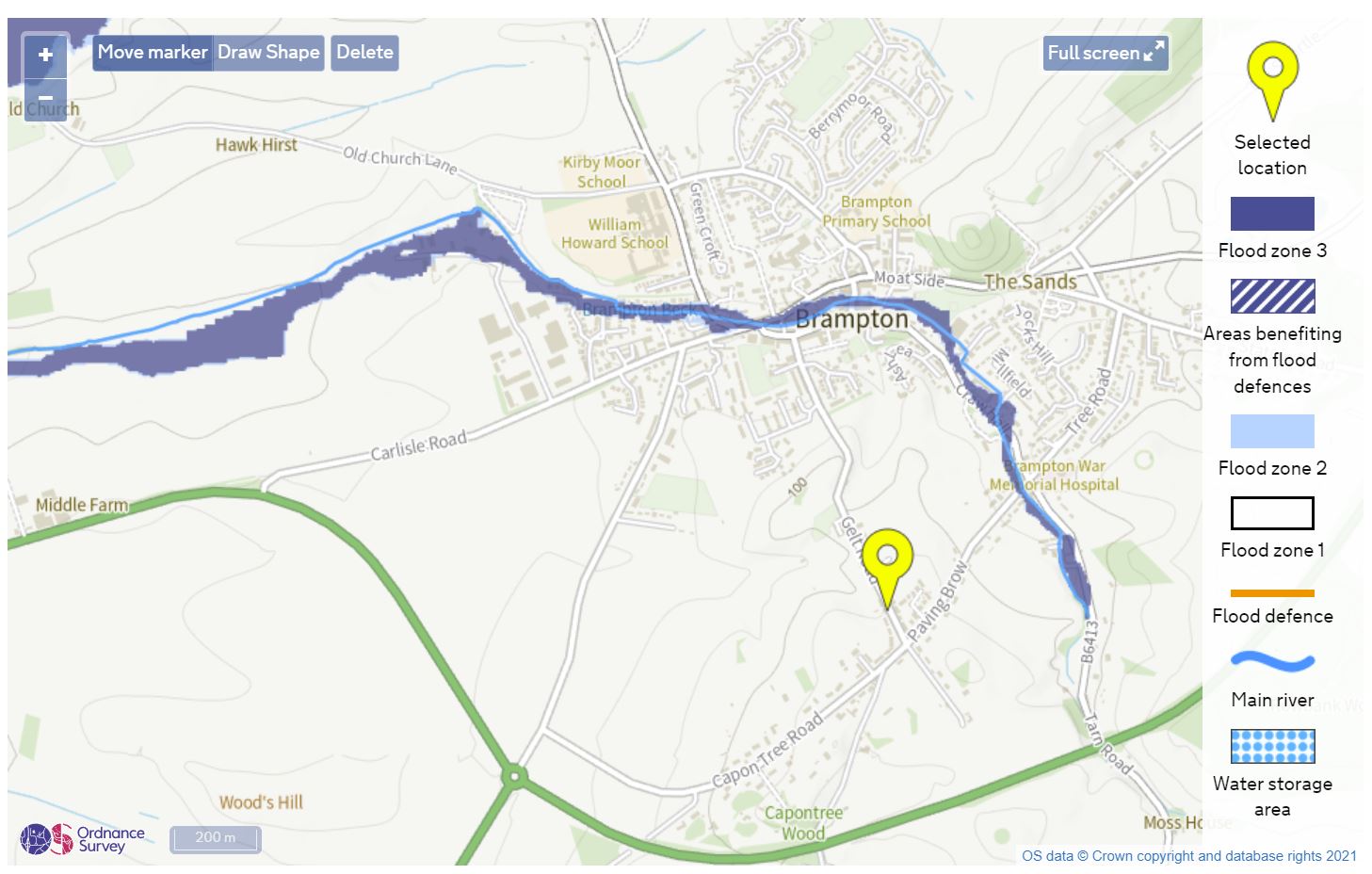
Flooding in Brampton ( town area) is rare, historically however a small stream runs through the middle of Brampton, known as Brampton Beck. Most of its route is now underground but appears briefly near Well Meadow. A number of old photopgraphs show water levels above the first floor windows. There is now a monitoring station nearby. The beck is mostly visible as it runs behind Beck Riggs and towards the River Irthing.
We are also close to the River Irthing, where flooding can occur mainly over farmland and fields either side of Irthing Bridge A6071. The road can be closed from time to time and there are normally limited, or no warning signs.
The River Gelt runs to the south of Brampton. It can be fast flowing and rises very quickly during heavy rainfall, and falls just as quick. However overtime its made a narrow gorge for itself and apart from a few local footpaths doesnt flood until it reaches its confluence with the Irthing well away from property
Flood Map of Brampton, from the GOV.UK website
Check for flooding at Brampton Beck - click here
Check for flooding at River Eden, Little Corby - click here
Check for flooding at River Gelt - https://check-for-flooding.service.gov.uk/station/5074
Check for flooding River Irthing at Greenholme - click here
Regional Rainfall last 24hrs (EA sites) - click here